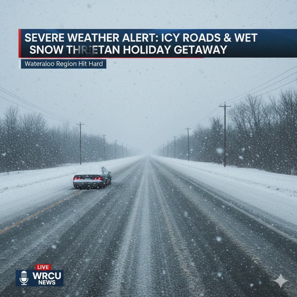
As thousands of residents prepare to begin their holiday travels, a powerful winter weather system is set to create challenging and potentially hazardous conditions across Waterloo Region and surrounding areas. Commuters heading out Friday are being urged to use extreme caution as icy roads, wet snow, and strong winds combine to make travel difficult throughout the day and into the evening.
A special weather statement issued early Friday morning highlights a rapidly changing forecast that could significantly impact driving conditions, public transit, and regional safety. Meteorologists warn that what begins as rain is expected to quickly transition into snow, followed by freezing temperatures that may cause widespread ice formation on roads and sidewalks.
Rapid Weather Shift Creates Risky Travel Conditions
Environment Canada and local weather experts say a strong cold front is responsible for the sudden and dramatic change in conditions. The system is expected to sweep through the region during the morning hours, bringing heavy rainfall initially before temperatures plunge.
According to the advisory, rain will gradually change to wet snow as colder air moves in. As temperatures fall below the freezing mark, any remaining moisture on roadways is likely to freeze, creating slick and dangerous surfaces. The timing of this transition is particularly concerning, as it coincides with peak commuting hours and the start of many holiday getaway trips.
Wind Gusts Add to the Hazard
In addition to freezing precipitation, strong winds are expected to intensify the situation. Wind gusts could reach up to 80 kilometres per hour in some areas, further reducing visibility and increasing the risk of accidents.
These powerful gusts may also lead to localized power outages, particularly in areas where ice accumulates on power lines or tree branches. Officials are urging residents to be prepared for possible service disruptions and to secure loose outdoor items that could become hazardous in high winds.
Temperatures Plunge as Wind Chill Bites
570 NewsRadio Weather Specialist Denise Andreacchi explained that the temperature drop will be swift and noticeable. While morning temperatures may hover near seasonal norms, the arrival of the cold front will cause readings to fall sharply by midday.
By Friday afternoon, the combination of falling temperatures and strong winds could make it feel closer to -10°C when factoring in wind chill. This sudden cold snap increases the likelihood of ice forming quickly, catching drivers and pedestrians off guard.
Snow Squall Warning Issued for Evening Hours
As conditions deteriorate later in the day, Environment Canada issued a yellow warning for snow squalls expected Friday evening. These squalls could bring brief periods of heavy snowfall, reduced visibility, and rapidly changing road conditions, especially in open or rural areas.
Forecasters say the snow squalls are expected to weaken overnight, but not before posing additional challenges for those traveling later in the evening. Motorists are advised to monitor weather updates closely and adjust travel plans if possible.
Police Urge Caution on Highways and Local Roads
The Ontario Provincial Police (OPP) have also issued warnings about hazardous travel conditions, with particular concern for a historically dangerous stretch of Highway 401 between Kitchener and Woodstock. This section of highway has already seen incidents during previous winter storms, and officers fear icy surfaces could once again lead to collisions.
“When You See Ice, Think Twice”
OPP Sergeant Sanchuk emphasized the importance of defensive driving during severe winter weather. He urged motorists to slow down and remain alert, especially when encountering icy patches that may not be immediately visible.
“The drive could be a challenging one,” he said. “When you see ice, think twice. Reduce your speed, drive according to the road and weather conditions, and make sure you leave enough distance between your vehicle and others.”
Sergeant Sanchuk also stressed the importance of clearing all ice and snow from vehicles before heading out. This includes windshields, side and rear windows, mirrors, roofs, and lights.
“If you can’t see it, how can you avoid it?” he added, reminding drivers that snow blowing off vehicles can pose a serious risk to others on the road.
Impact on Schools and Transportation
The icy conditions have already affected student transportation in parts of the region. School bus cancellations were reported in some areas of Wellington County due to unsafe road conditions. However, buses continued to operate in Guelph, and there were no cancellations reported in Waterloo Region at the time of the advisory.
Parents and guardians are encouraged to check with local school boards and transportation providers for the latest updates, as conditions may change throughout the day.
Holiday Travel Complications Expected
With the holiday season in full swing, the timing of the storm presents added challenges for travelers. Many residents are expected to hit the roads to visit family or begin vacation trips, increasing traffic volumes during an already hazardous weather event.
Transportation officials recommend allowing extra travel time, avoiding unnecessary trips during peak storm periods, and considering delaying travel until conditions improve, particularly during the evening snow squalls.
Tips for Safe Winter Driving
Authorities and weather experts are offering several reminders to help reduce risk during winter travel:
-
Slow down and avoid sudden braking or sharp turns
-
Increase following distance between vehicles
-
Use winter tires when possible
-
Keep headlights on for better visibility
-
Carry an emergency kit, including blankets, water, and a flashlight
Drivers are also encouraged to stay informed by listening to local radio stations or checking official weather and traffic updates before heading out.
Broader Winter Weather Context
The storm marks a sharp contrast to the milder conditions experienced earlier in December, when unseasonably warm air brought rain rather than snow to much of southern Ontario. Meteorologists say this latest system is a reminder that winter weather can arrive suddenly and with little margin for error.
Recent advisories from regional authorities have also warned about thin ice forming on rivers, ponds, and conservation areas, emphasizing that fluctuating temperatures make ice conditions unpredictable and dangerous.
Conclusion: Caution Key as Winter Tightens Its Grip
As Waterloo Region braces for icy roads, wet snow, and powerful winds, officials are urging residents to prioritize safety over speed or convenience. The combination of rapidly changing weather, freezing temperatures, and increased holiday traffic creates a perfect storm for accidents if caution is not exercised.
While conditions are expected to improve overnight, the immediate hours ahead could be challenging for commuters and travelers alike. By staying informed, adjusting travel plans, and following safety advice from authorities, residents can reduce risks and help ensure a safer start to the holiday season.
For the latest weather alerts and traffic updates, residents are encouraged to monitor official forecasts and local news throughout the day.
Leave a Reply